________________
Chapter 06
Climate and Study of Glaciers
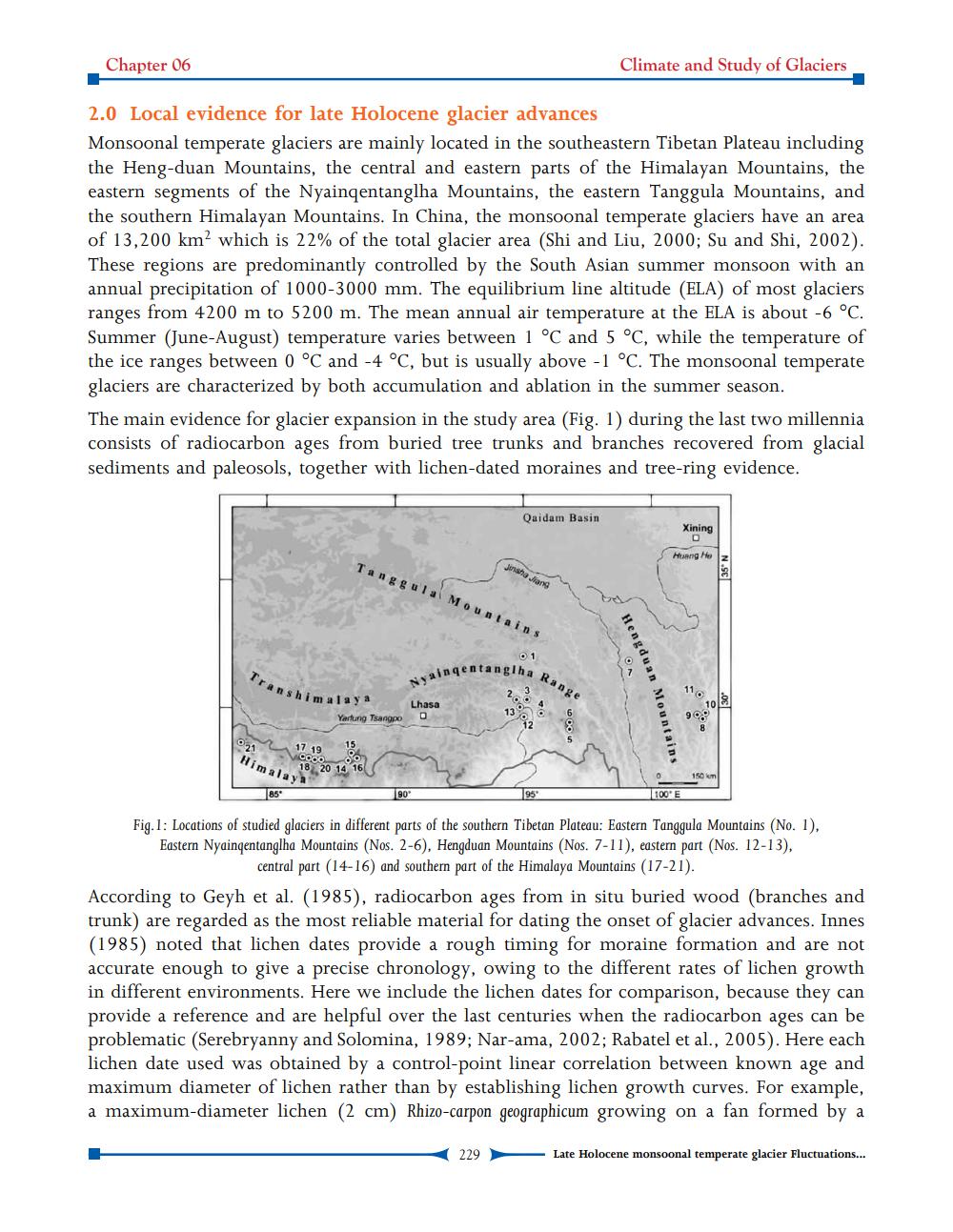
2.0 Local evidence for late Holocene glacier advances Monsoonal temperate glaciers are mainly located in the southeastern Tibetan Plateau including the Heng-duan Mountains, the central and eastern parts of the Himalayan Mountains, the eastern segments of the Nyainqentanglha Mountains, the eastern Tanggula Mountains, and the southern Himalayan Mountains. In China, the monsoonal temperate glaciers have an area of 13,200 km? which is 22% of the total glacier area (Shi and Liu, 2000; Su and Shi, 2002). These regions are predominantly controlled by the South Asian summer monsoon with an annual precipitation of 1000-3000 mm. The equilibrium line altitude (ELA) of most glaciers ranges from 4200 m to 5200 m. The mean annual air temperature at the ELA is about -6 °C. Summer (June-August) temperature varies between 1 °C and 5 °C, while the temperature of the ice ranges between 0 °C and -4 °C, but is usually above -1 °C. The monsoonal temperate glaciers are characterized by both accumulation and ablation in the summer season. The main evidence for glacier expansion in the study area (Fig. 1) during the last two millennia consists of radiocarbon ages from buried tree trunks and branches recovered from glacial sediments and paleosols, together with lichen-dated moraines and tree-ring evidence.
Qaidam Basin
Xining
Heng Hey
Tanggula Mountains
N.SE
• 1
Hengduan
Tran
in qentanglha
Range
Nyainge
shimalaya
tengduan Mountains
Lhasa
O
Yartung Tsangpo
0.6
2117 1915 Cooo
ROS im 18 20 14 16
Himalaya
150
0 100' E
85"
Fig. 1: Locations of studied glaciers in different parts of the southern Tibetan Plateau: Eastern Tanggula Mountains (No. 1). Eastern Nyainqentanglha Mountains (Nos. 2-6), Hengduan Mountains (Nos. 7-11), eastern part (Nos. 12-13).
central part (14-16) and southern part of the Himalaya Mountains (17-21). According to Geyh et al. (1985), radiocarbon ages from in situ buried wood (branches and trunk) are regarded as the most reliable material for dating the onset of glacier advances. Innes (1985) noted that lichen dates provide a rough timing for moraine formation and are not accurate enough to give a precise chronology, owing to the different rates of lichen growth in different environments. Here we include the lichen dates for comparison, because they can provide a reference and are helpful over the last centuries when the radiocarbon ages can be problematic (Serebryanny and Solomina, 1989; Nar-ama, 2002; Rabatel et al., 2005). Here each lichen date used was obtained by a control-point linear correlation between known age and maximum diameter of lichen rather than by establishing lichen growth curves. For example, a maximum-diameter lichen (2 cm) Rhizo-carpon geographicum growing on a fan formed by a
229
Late Holocene monsoonal temperate glacier Fluctuations...