________________
Shri Ashtapad Maha Tirth - II
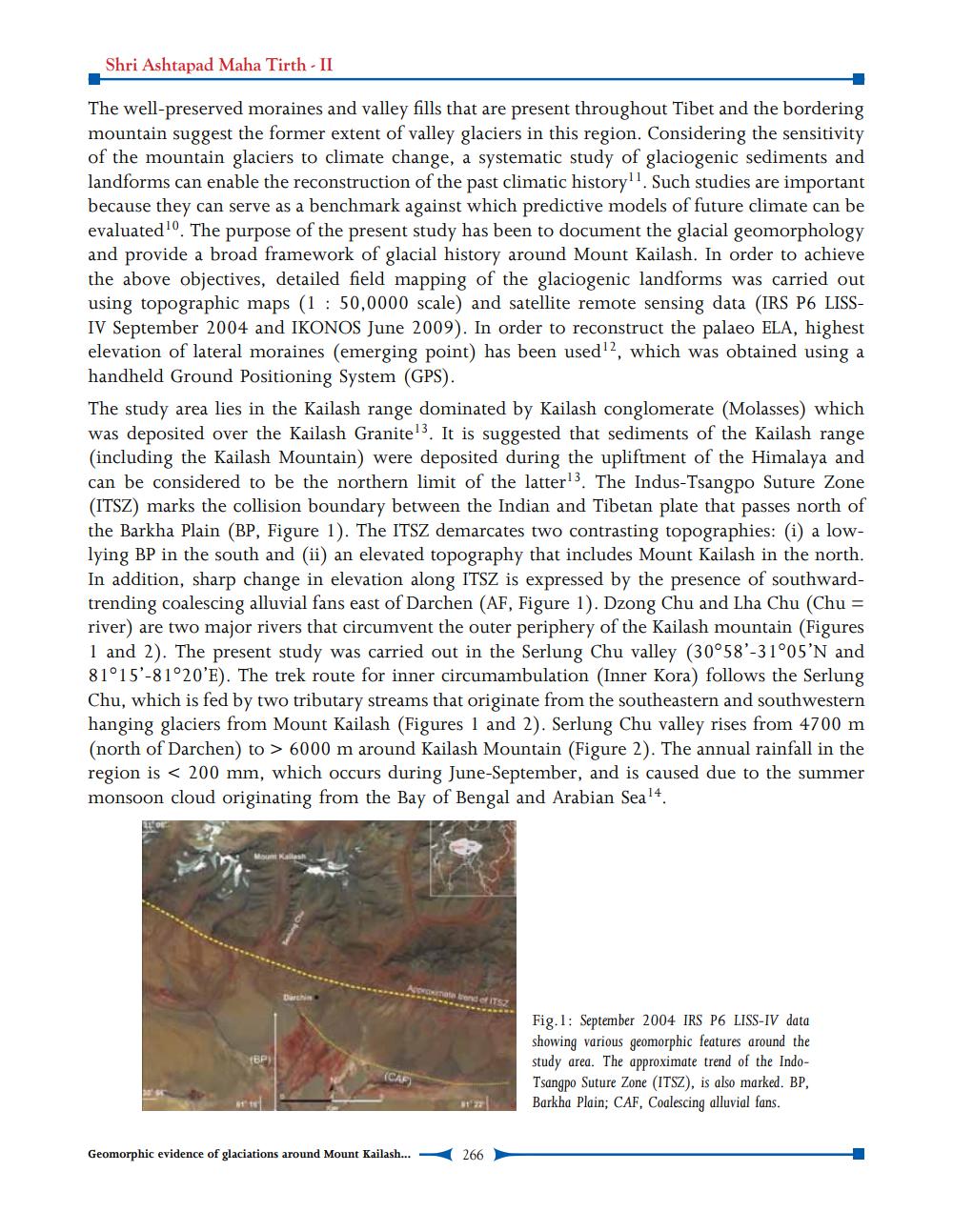
The well-preserved moraines and valley fills that are present throughout Tibet and the bordering mountain suggest the former extent of valley glaciers in this region. Considering the sensitivity of the mountain glaciers to climate change, a systematic study of glaciogenic sediments and landforms can enable the reconstruction of the past climatic history. Such studies are important because they can serve as a benchmark against which predictive models of future climate can be evaluated 10. The purpose of the present study has been to document the glacial geomorphology and provide a broad framework of glacial history around Mount Kailash. In order to achieve the above objectives, detailed field mapping of the glaciogenic landforms was carried out using topographic maps (1 : 50,0000 scale) and satellite remote sensing data (IRS P6 LISSIV September 2004 and IKONOS June 2009). In order to reconstruct the palaeo ELA, highest elevation of lateral moraines (emerging point) has been used, which was obtained using a handheld Ground Positioning System (GPS). The study area lies in the Kailash range dominated by Kailash conglomerate (Molasses) which was deposited over the Kailash Granitel3. It is suggested that sediments of the Kailash range (including the Kailash Mountain) were deposited during the upliftment of the Himalaya and can be considered to be the northern limit of the latter!3. The Indus-Tsangpo Suture Zone (ITSZ) marks the collision boundary between the Indian and Tibetan plate that passes north of the Barkha Plain (BP, Figure 1). The ITSZ demarcates two contrasting topographies: (i) a lowlying BP in the south and (ii) an elevated topography that includes Mount Kailash in the north. In addition, sharp change in elevation along ITSZ is expressed by the presence of southwardtrending coalescing alluvial fans east of Darchen (AF, Figure 1). Dzong Chu and Lha Chu (Chu = river) are two major rivers that circumvent the outer periphery of the Kailash mountain (Figures 1 and 2). The present study was carried out in the Serlung Chu valley (30°58'-31°05'N and 81°15'-81°20'E). The trek route for inner circumambulation (Inner Kora) follows the Serlung Chu, which is fed by two tributary streams that originate from the southeastern and southwestern hanging glaciers from Mount Kailash (Figures 1 and 2). Serlung Chu valley rises from 4700 m (north of Darchen) to > 6000 m around Kailash Mountain (Figure 2). The annual rainfall in the region is < 200 mm, which occurs during June-September, and is caused due to the summer monsoon cloud originating from the Bay of Bengal and Arabian Seal4.
Fig.1: September 2004 IRS P6 LISS-IV data showing various geomorphic features around the study area. The approximate trend of the IndoTsangpo Suture Zone (ITSZ), is also marked. BP, Barkha Plain; CAF, Coalescing alluvial fans.
(CAF)
Geomorphic evidence of glaciations around Mount Kailash...
266