________________
જૈન લોકના ચિત્રની સાંખ્યિકી પદ્ધતિ દ્વારા વ્યાખ્યાની આવશ્યકતા
87
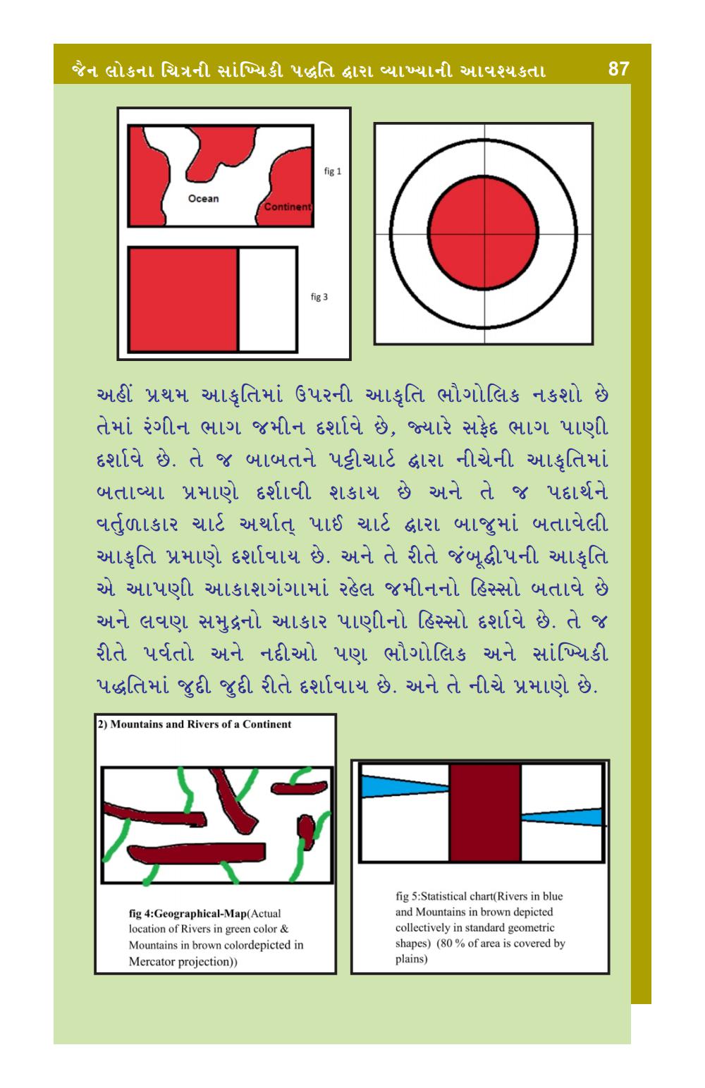
Ocean
Continent
fig 3
અહીં પ્રથમ આકૃતિમાં ઉપરની આકૃતિ ભૌગોલિક નકશો છે તેમાં રંગીન ભાગ જમીન દર્શાવે છે, જ્યારે સફેદ ભાગ પાણી દર્શાવે છે. તે જ બાબતને પટ્ટીચાર્ટ દ્વારા નીચેની આકૃતિમાં બતાવ્યા પ્રમાણે દર્શાવી શકાય છે અને તે જ પદાર્થને વર્તુળાકાર ચાર્ટ અર્થાત્ પાઈ ચાર્ટ દ્વારા બાજુમાં બતાવેલી આકૃતિ પ્રમાણે દર્શાવાય છે. અને તે રીતે જંબુદ્વીપની આકૃતિ એ આપણી આકાશગંગામાં રહેલ જમીનનો હિસ્સો બતાવે છે અને લવણ સમુદ્રનો આકાર પાણીનો હિસ્સો દર્શાવે છે. તે જ રીતે પર્વતો અને નદીઓ પણ ભૌગોલિક અને સાંખ્યિકી પદ્ધતિમાં જુદી જુદી રીતે દર્શાવાય છે. અને તે નીચે પ્રમાણે છે.
2) Mountains and Rivers of a Continent
fig 4:Geographical-Map(Actual location of Rivers in green color & Mountains in brown colordepicted in Mercator projection))
fig 5:Statistical chart(Rivers in blue and Mountains in brown depicted collectively in standard geometric shapes) (80 % of area is covered by plains)