SearchBrowseAboutContactDonate
Page Preview
Page 117
Loading...
Download File
Download File
Page Text
________________ MOUNTAIN TERRITORIES. 
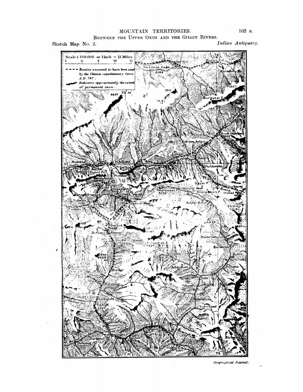
102 a. BETWEEN THE UPPER OXUS AND THE GILGIT RIVERS. Sketch Map No. 2. Indian Antiquary. Scale 1 700,000 or 1 Inch - 11 Miles 4084 ---- Routes assumed to have been used by the Chinese speditionary force. 4. D 747 Indicates apparimately the extent of permanent snow. 2 5627 5411 5637 73 30 VE Geographical Journal.
SR No.032544
Book TitleIndian Antiquary Vol 52
Original Sutra AuthorN/A
AuthorRichard Carnac Temple, Stephen Meredyth Edwardes, Krishnaswami Aiyangar
PublisherSwati Publications
Publication Year1985
Total Pages568
LanguageEnglish
ClassificationBook_English
File Size24 MB
Copyright © Jain Education International. All rights reserved. | Privacy Policy