________________
372
THE INDIAN ANTIQUARY.
[DECEMBER, 1884
people the Kattabaidd is not noticed in any map or sea chart whatever. It was first brought to light by the late Mr. Burrows, an able astronomer, who visited that part of the coast by order of Government. In the language of that country kátú is a fort and Byeitza or Baidza is the name of a tribe in that country." (Asiat. Ros., vol. XIV, pp. 452, 453).
Barakoura:-This mart is placed in Yule's map at Ramki, called otherwise Ramu, a town lying 68 miles S.S.E. of Chittagong..
Mouth of the Tokosanna:- This river Wil. ford and Lassen (Ind. Au., vol. III, p. 237) identified with the Arakan river. Yule prefers the N&f, which is generally called the Teke-naf, from the name of a tribe inhabiting its banks.
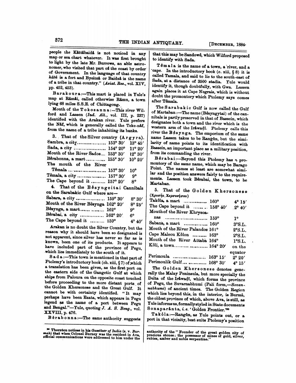
3. That of the Silver country (Argyra). Sambra, a city.
................. 153° 30 13° 45' Sada, & city .................... 154° 20° 11° 20 Mouth of the River Sados... 153° 30' 12° 30' Bêrabonna, a mart ............ 155° 30' 10 20 The mouth of the River
Têmala ....................... 157° 30' 10° Témala, a city .................. 157° 30' 9° The Cape beyond it ......... 157° 20' 8°
4. That of the Bê syngeitai Cannibals on the Sarabakic Gulf wbere areSabara, a city .................. 159° 30' 8° 30' Mouth of the River Begynga 162° 20° 8° 25' Bêsynga, a mart.............. 162° 9° Berabai, a city ............... 162° 20' 6° The Cape beyond it ......... 159° 4° 40'
Arakan is no doubt the Silver Country, but the reason why it should have been so designated is not apparent, since silver has never so far as is known, been one of its products. It appears to have included part of the province of Pegu, which lies immediately to the south of it.
Sada :-This town is mentioned in that part of Ptolemy's introductory book (ch. xiii, $7) of which a translation has been given, as the first port on the eastern side of the Gangetic Gulf at which ships from Paloura on the opposite coast touched before proceeding to the more distant porta of the Golden Khersonese and the Great Gulf. It cannot be with certainty identified. "It may perhaps have been Ezata, which appears in Pegu legend as the name of a port between Pegu and Bengal."-Yule, quoting J. 4. 8. Beng., vol. XXVIII, p. 476.
Bérabonna:-The same authority suggests
that this may be Sandowê, which Wilford proposed to identify with Sada.
Tomala is the name of a town, a river, and a cape. In the introductory book (c. xiii, 9 8) it is called Tamala, and said to lie to the south-east of Sada, at a distance of 3500 stadia. Yule would identify it, though doubtfully, with Gwa. Lassen again places it at Cape Negrais, which is without doubt the promontory which Ptolemy says comes after Temala.
The Sarabakie Gulf is now called the Gulf of Martaban :-The name (Bêsyngytai) of the can. nibals is partly preserved in that of Bassein, which designates both a town and the river which is the western arm of the Irwadi. Ptolemy calls this river the Bēsynga. The emporium of the same name Lassen takes to be Rangan, but the simi. larity of name points to its identification with Bassein, an important place as a military position, from its commanding the river.
Borabai: Beyond this Ptolemy has promontory of the same name, which may be Barago Point. The names at least are somewhat simi. lar and the position answers fairly to the requirementa. Lassen took Berabai, the town, to be Martaban.
5. That of the Golden Khersonese (Xpuois. Xepoorýcov) Takola, & mart
4° 15 The Cape beyond it ........ 158° 40' 2° 40' Mouth of the River Khrysosnas
............... 159° Sabana, a mart ............... 160° 3°S.L. Mouth of the River Palandos 161° 23.L. Cape Maleou Kolon ......... 163°
2°S.L. Mouth of the River Attaba 164°
1°S.L. Koli, a town........ ...... 164° 20 on the
equator Perimoula ...................... 163° 15' 2° 20' Perimoulik Gulf ............... 168° 30° 4° 15'
The Golden Khersonese denotes generally the Malay Peninsula, but more specially the Delta of the Irawadt, which forms the province of Pegu, the Suvarnabhumi (Pali form, -Sovan nabhumi) of ancient times. The Golden Region which lies beyond this, in the interior, is Burma, the oldest province of which, above Ava, is still, Yule informs us, formally styled in State documenta Sonaparánta, i.e.Golden Frontier."
Takola:-Rangan, as Yule points out, or a port in that vioinity, best suita Ptolemy's position
...... 160°
10
Thornton notices in his Gavetteer of India (s. v. Bur. mah) that when Colonel Burney was the resident in Ava, oficial communications were addressed to him under the
Authority of the "Founder of the great golden city of precious stones; the possessor of mines of gold, silver, rabies, Amber and noble serpentina."


