________________
Shri Ashtapad Maha Tirth - II
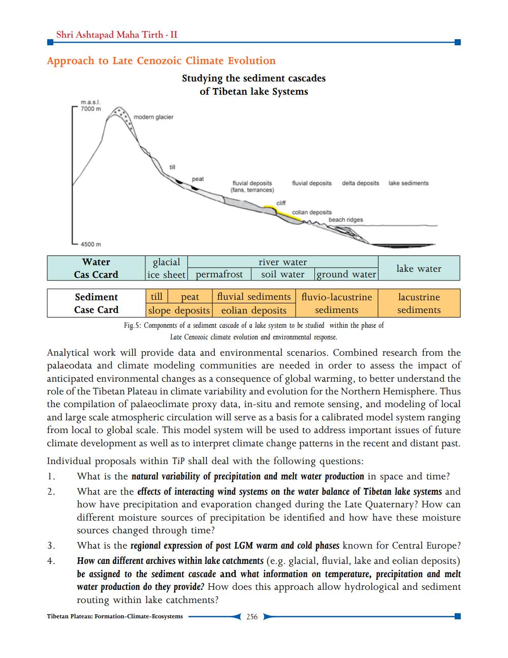
Approach to Late Cenozoic Climate Evolution
1.
2.
m.a.s.l. 7000 m
4500 m
3.
4.
Water Cas Ccard
Sediment
Case Card
modern glacier
Studying the sediment cascades of Tibetan lake Systems
peat
fluvial deposits (fans, terrances)
glacial
ice sheet permafrost
cliff
till peat fluvial sediments slope deposits eolian deposits
fluvial deposits delta deposits lake sediments
colian deposits
beach ridges
river water
soil water ground water
256
fluvio-lacustrine sediments
Fig.5: Components of a sediment cascade of a lake system to be studied within the phase of Late Cenozoic climate evolution and environmental response.
Analytical work will provide data and environmental scenarios. Combined research from the palaeodata and climate modeling communities are needed in order to assess the impact of anticipated environmental changes as a consequence of global warming, to better understand the role of the Tibetan Plateau in climate variability and evolution for the Northern Hemisphere. Thus the compilation of palaeoclimate proxy data, in-situ and remote sensing, and modeling of local and large scale atmospheric circulation will serve as a basis for a calibrated model system ranging from local to global scale. This model system will be used to address important issues of future climate development as well as to interpret climate change patterns in the recent and distant past. Individual proposals within TiP shall deal with the following questions:
lake water
lacustrine sediments
What is the natural variability of precipitation and melt water production in space and time? What are the effects of interacting wind systems on the water balance of Tibetan lake systems and how have precipitation and evaporation changed during the Late Quaternary? How can different moisture sources of precipitation be identified and how have these moisture sources changed through time?
What is the regional expression of post LGM warm and cold phases known for Central Europe? How can different archives within lake catchments (e.g. glacial, fluvial, lake and eolian deposits) be assigned to the sediment cascade and what information on temperature, precipitation and melt water production do they provide? How does this approach allow hydrological and sediment routing within lake catchments?
Tibetan Plateau: Formation-Climate-Ecosystems