________________
Chapter 05
Geological Studies
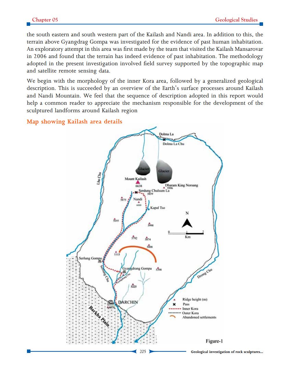
the south eastern and south western part of the Kailash and Nandi area. In addition to this, the terrain above Gyangdrag Gompa was investigated for the evidence of past human inhabitation. An exploratory attempt in this area was first made by the team that visited the Kailash Mansarovar in 2006 and found that the terrain has indeed evidence of past inhabitation. The methodology adopted in the present investigation involved field survey supported by the topographic map and satellite remote sensing data. We begin with the morphology of the inner Kora area, followed by a generalized geological description. This is succeeded by an overview of the Earth's surface processes around Kailash and Nandi Mountain. We feel that the sequence of description adopted in this report would help a common reader to appreciate the mechanism responsible for the development of the sculptured landforms around Kailash region Map showing Kailash area details
....
...
Dolma La
Dolma La Chu
Glacier
Glacier
Lha Chu
Mount Kailash 6638
Dharam King Norsang Lax Serdung Chulsurna
A
5005
5875
Nandi
Kapal Tso
ORDENANCE
Serlung Gompa
Gyapdrang Gompa
sfus
SciTung Chu
Drong Chu
1..:11:1:1:1:1:
1:1:: :1: 1
: :1:1:1:1.0:
1 11111111111111111111
: :
1 1.1.1.1.1.1.1.1.1.1.1.1.1.1.1.
:1:11::1:1:1:1 111111111111111 13111111 111 111111111111111111:
1:1:1:1
ISO 1211111111111111
: 1:1:1:1:1:11 10:11:1:1:: 1:1:1:1 11:
DARCHIN
Ridge height (m)
Pass
-- Inner Kora ****Outer Kora
Abandoned settlements
AN
:1:1.0: LIII1IIIII 11:1:1:1
TIT 1:1:1.:
11:1:1:1:1:1 11111 INI.1.1.1:
R:11:01 11:11 1.1. :
100
III:I::
Figure-1
205
Geological investigation of rock sculptures...