________________
Shri Ashtapad Maha Tirth - II
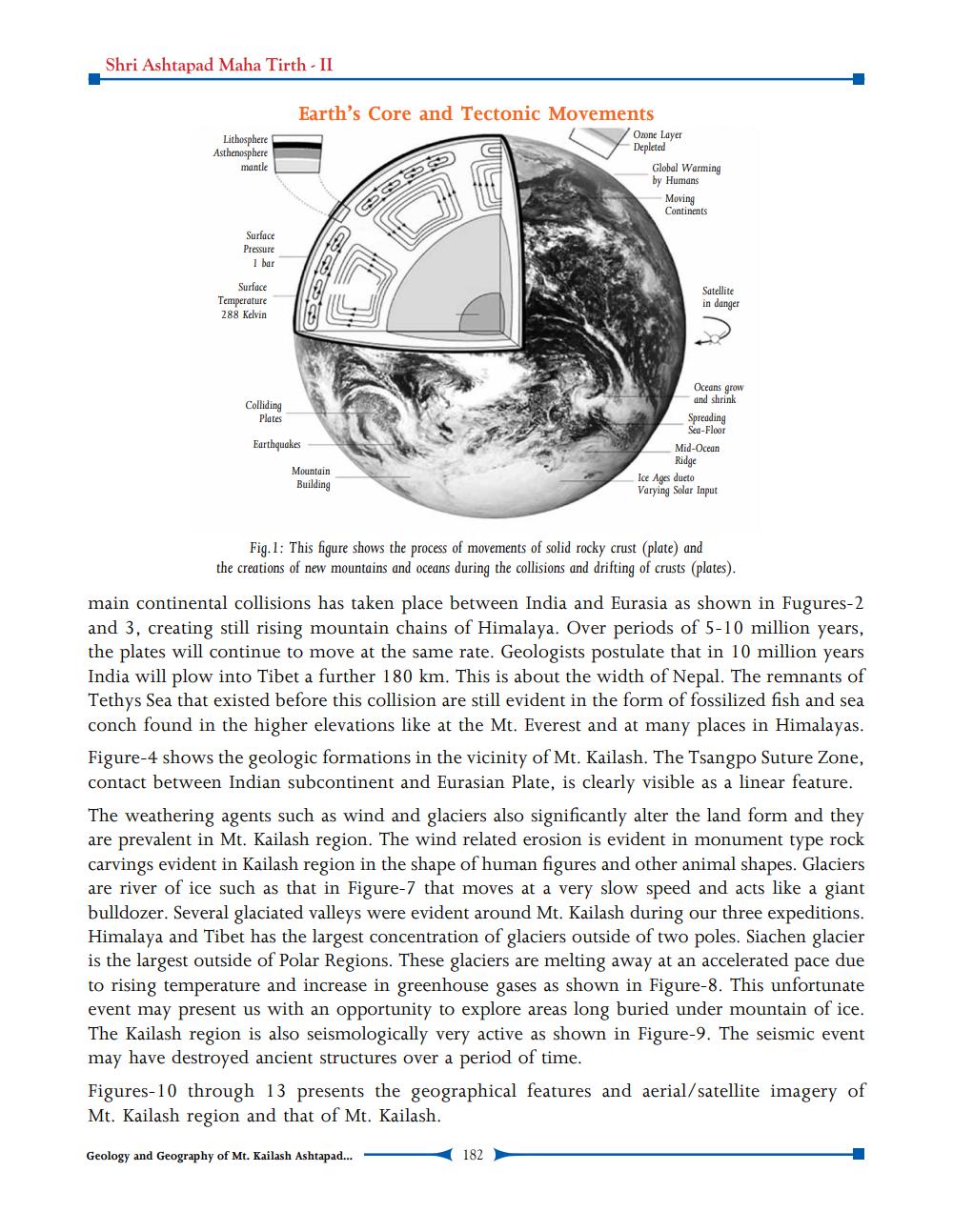
Earth's Core and Tectonic Movements
Lithosphere Asthenosphere
mantle
Ozone Layer Depleted
Global Warming by Humans
Moving Continents
Surface Pressure
1 bar
Surface Temperature 288 Kelvin
Satellite in danger
Colliding
Plates
Earthquakes
Oceans grow
and shrink Spreading
Sea-Floor Mid-Ocean
Ridge Ice Ages dueto Varying Solar Input
Mountain Building
Fig. 1: This figure shows the process of movements of solid rocky crust (plate) and the creations of new mountains and oceans during the collisions and drifting of crusts (plates).
main continental collisions has taken place between India and Eurasia as shown in Fugures-2 and 3, creating still rising mountain chains of Himalaya. Over periods of 5-10 million years, the plates will continue to move at the same rate. Geologists postulate that in 10 million years India will plow into Tibet a further 180 km. This is about the width of Nepal. The remnants of Tethys Sea that existed before this collision are still evident in the form of fossilized fish and sea conch found in the higher elevations like at the Mt. Everest and at many places in Himalayas. Figure-4 shows the geologic formations in the vicinity of Mt. Kailash. The Tsangpo Suture Zone, contact between Indian subcontinent and Eurasian Plate, is clearly visible as a linear feature. The weathering agents such as wind and glaciers also significantly alter the land form and they are prevalent in Mt. Kailash region. The wind related erosion is evident in monument type rock carvings evident in Kailash region in the shape of human figures and other animal shapes. Glaciers are river of ice such as that in Figure-7 that moves at a very slow speed and acts like a giant bulldozer. Several glaciated valleys were evident around Mt. Kailash during our three expeditions. Himalaya and Tibet has the largest concentration of glaciers outside of two poles. Siachen glacier is the largest outside of Polar Regions. These glaciers are melting away at an accelerated pace due to rising temperature and increase in greenhouse gases as shown in Figure-8. This unfortunate event may present us with an opportunity to explore areas long buried under mountain of ice. The Kailash region is also seismologically very active as shown in Figure-9. The seismic event may have destroyed ancient structures over a period of time. Figures-10 through 13 presents the geographical features and aerial/satellite imagery of Mt. Kailash region and that of Mt. Kailash.
Geology and Geography of Mt. Kailash Ashtapad...
182