________________
High Resolution 3-D Imagery of Kailash Region
Shashikant Sharma and P.S. Thakker
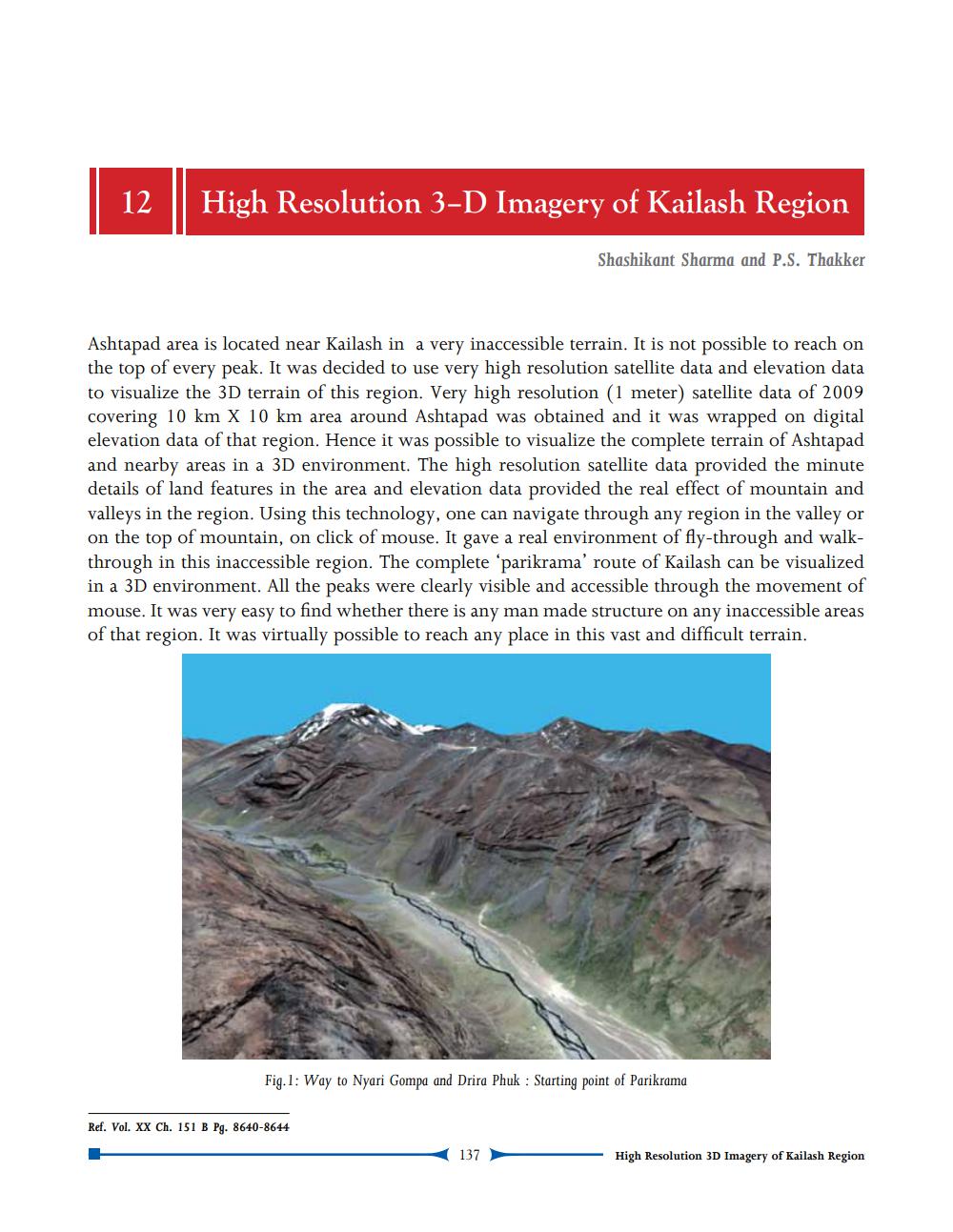
Ashtapad area is located near Kailash in a very inaccessible terrain. It is not possible to reach on the top of every peak. It was decided to use very high resolution satellite data and elevation data to visualize the 3D terrain of this region. Very high resolution (1 meter) satellite data of 2009 covering 10 km X 10 km area around Ashtapad was obtained and it was wrapped on digital elevation data of that region. Hence it was possible to visualize the complete terrain of Ashtapad and nearby areas in a 3D environment. The high resolution satellite data provided the minute details of land features in the area and elevation data provided the real effect of mountain and valleys in the region. Using this technology, one can navigate through any region in the valley or on the top of mountain, on click of mouse. It gave a real environment of fly-through and walkthrough in this inaccessible region. The complete parikrama' route of Kailash can be visualized in a 3D environment. All the peaks were clearly visible and accessible through the movement of mouse. It was very easy to find whether there is any man made structure on any inaccessible areas of that region. It was virtually possible to reach any place in this vast and difficult terrain.
Fig.1: Way to Nyari Gompa and Drira Phuk : Starting point of Parikrama
Ref. Vol. XX Ch. 151 B Pg. 8640-8644
137
High Resolution 3D Imagery of Kailash Region